
Against the green hills of Johor, she lies quietly on the deep blue waters as tiny boats and ships go about their daily business in front of her. The silence was occasionally interrupted by the roaring engines of white metal birds that have descended upon the grey runaways of a nearby international airport. As night falls, the island was shrouded in darkness under a sky of midnight blue. The bright lights of the mainland obscured the ocean of stars that covered the entire sky. However Pulau Tekong, forming a contrasting image of mainland Singapore provides her residents a breathe-taking view of the starry night.
Lying in between Singapore and Malaysia on Selat Johor, Pulau Tekong is Singapore’s largest outlying island with an area of 24.43 km3. The figure continues to increase day by day as land reclamation efforts continues to expand the island’s land area. Today Pulau Tekong, like Jurong Island in the Southwest is an amalgamation of islands consisting of Pulau Tekong, Pulau Unum, Pulau Sejahat, Pulau Tekong Kechil, Pulau Semechek, Pulau Sanyongkong and other tiny islands that surrounded Tekong in the past. The island used to be inhabited by people until resettlement took hold and made it a restricted area for the military where most males like me did our basic military training.
According to infopedia.nl.sg, 4,000 people who were mainly Malays used to live in Pulau Tekong in 1956. It was a time when Pulau Tekong was like her neighbour Pulau Ubin, where kampongs and dirt roads still exist and time seemed to have frozen compared to mainland Singapore. Furthermore, it was an island producing rubber, coconut, vegetacles, prawns, fish and tropical fruits.
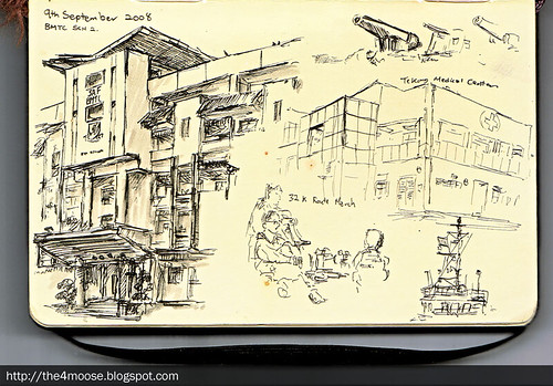
Recruit Booking In.
Every day, ferries interrupted the serenity of this largely green island, carrying many recruits to and fro Pulau Tekong. Four islands guard the bay of Tekong which has formed as a result of land reclamation. The island of Pulau Tekong Kechil and Pulau Semechek flanked the west side of the bay and the islands of Pulau Sejahat Kechil and Pulau Sejahat stood at the east side of the bay. Today these islands are joined to Pulau Tekong by strips of reclaimed land.

The land reclamation seemed to slow down after 2003/2004.
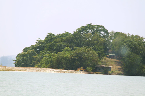
Among these four islands, Pulau Sejahat is the most significant. This green little mound has been in the view of the public and the many army personnel who went past it each day. A standalone plaque dedicated to this unknown island stood along Changi Beach Park today.
“When Singapore was a British colony, the island was possibly part of the integral defence of the Johore Straits, together with Pulau Tekong and Changi Point. The gun battery positions on Pulau Sejahat could have been intended to protect the stretch of water between Changi and Pulau Tekong, so as to extend the coverage provided by the neighbouring coastal defence batteries.
In 1972, Pulau Sejahat was returned to the Singapore government. Today, remains of barrack buildings, gun emplacements and lookout posts can be found on the island.”
Furthermore, there is an elaboration of British Fortifications:
“Pulau Sejahat is the last islet here where British-built fortifications can be found. It houses two gun sites, two anti-aircraft gun posts, bunkers for troops and a pair of towers built to control gunfire from Pulau Sejahat. Its main weapons were a pair of twin QF six-pounder guns that could fire one 2.7 kg shell a second. They could be used against fast-moving boats or low-flying aircraft given their quick firing capability for their time. As part of the British coastal defence network of what was called Fortress Singapore, the islet's battery complemented larger guns in forts at Changi, Pulau Tekong and Johor to protect shipping routes leading to the Royal Navy's base in Sembawang.“
- National Heritage Board
Today public access to the island has been prohibited as it is now part of SAF Training Areas. Fortunately, after some searching around the net, I happened to chance upon some photos taken by Dr. John Larkin. He visited the island along with Pulau Tekong before it was cordoned off to the public. His photos can be found here.
You will realize that besides British fortifications, you can also spot a shrine on Pulau Sejahat. According to what I have read, it was a shrine dedicated to a yellow rock that was found on the island long time ago and dedicated to the Tuan Po Kung. The shrine was visited by many people and probably army personnel as well today even though the public could no longer visit the shrine. Some trees had been cleared and the shrine can be viewed clearly as you made your way in and out of Tekong by the ferry today. You can also spot the British colonial structures that stood side by side with the shrine.
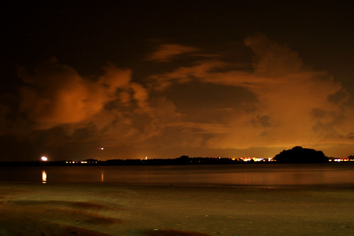
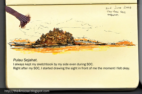
Pulau Sejahat at Night
Pulau Tekong is an island that is more than just huanted tales and army green. It is a lovely island with great scenery and most of it remained untouched by the rapid development in Singapore. For people who have photos of the island or have friends or relatives who stayed there long time ago, you are very fortunate.


I have black and white photos of Pulau Tekong during the late 1960's posted on my blog. Just check them out at my blog archives...under labels like " Tekong, TTC, YLTC ...".
ReplyDeletewebsite: www.uncledicko.blogspot.com
or just google "The Wise Old Owl".
Regards,
Unk Dicko
Hi unk Dicko,
ReplyDeleteThanks for the links to the photos!
I have seen them before I posted this =),
they are very precious, they provide glimpses of the Old Pulau Tekong that many of younger generations don't get to see except for old foundations or street signs that we might come across during our route marches there.
Many thanks,
Xin Li
Infopedia's entry about the island being largely Malay in 1956 is inaccurate. The island had more Chinese majority when the colonial government tried to expand the island for pepper and gambier plantations, and later for rubber plantations. If you get a chance, read Retrospect on the Dust-laden history: recollections by islanders and a good study of the history. cheers
ReplyDeleteThank you Sohkiak,
DeleteThis was in 2010 before the book was published in late 2011-2012. Back then, I was just out of NS from Tekong and did this post with what I found here and there from Infopedia, my older enciks and unk Dicko from the Wise Old Owl blog. I am glad that I eventually get read the book when it came out and used the materials to visualize Kampong Selabin last year.
Regards,
Xin Li