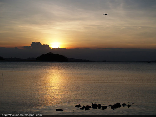
Sun Sets on Pulau Sejahat.
Shoulder to Shoulder – Tekong Days Pg.48
Published in 2002 by Mindef.
ISBN: 981-04-6931-4
Unk Dicko has got me really exciting with his recent series of posts about Pulau Tekong! So today, I want to share a bit of this mysterious island in the northeast where almost every Singaporean males has spent at least part of their National Service yet doesn’t know much about.
The northern part of Pulau Tekong is covered by thick forests, swamps and streams. Even before Tekong was turned into an exclusive SAF Training Area, not much was known of this area except for pockets of areas inhabited by people.
In army tongue, this northern area was commonly referred to as “Unum” (apart from from the CCPs). Unum has a notorious reputation with the army guys on Pulau Tekong. It was reputedly where most paranormal activities took place with stories like rovers cannot start engines ominously around 5pm, navigation would go haywire as groups get separated easily and soldiers going missing then being found just nearby and on and on.
Today Unum is still a densely forested area, occasionally used for army trainings and field camps at the southern part of Unum. Much of the area at the eastern portion are covered by swamps and streams, the most important one was called Sungei Belang. The areas surrounding Sungei Belang was labelled as Prawn Pond in the 1964 Map.
On the west side of Kampong Unum is Sungei Unum. On the east side of Kampong Unum is Sungei Belang with the surrounding areas labelled as Prawn Pond in the 1964 map and a rock named Batu Belalai nearby. To the west, is Sungei Unum and to the North beyond the coast is Pulau Unum which is slowly incorporated into Pulau Tekong through the effects of land reclamation.
Rewinding at least fifty years back, this desolate area has a few kampongs. Kampong Sungai Belang is one and the major settlement along the coast near Pulau Unum was Kampong Unum. Described as having an appearance similar to the Kampong villages along the coast in Johor today by my encik, Kampong Unum was considerably populated and it has a Malay cemetery within its vicinity and a provision store as well (thanks to Unk Dicko’s 1980 Master Map : )
Thanks to Google Earth, one can observed how nature took over the grounds of Kampong Unum after the resettlement, with the Historical Imagery feature, you could observe how a sparsely forested area became densely forested as time progresses indicating that the land was cleared and left untouched ever since the resettlement.
What is special about this area is that Singapore’s second hot spring is located in Unum. Yes, Singapore actually has two known hot springs. The more famous one is in Sembawang and the lesser known one which not many people get to see hot spring is located in Pulau Tekong.
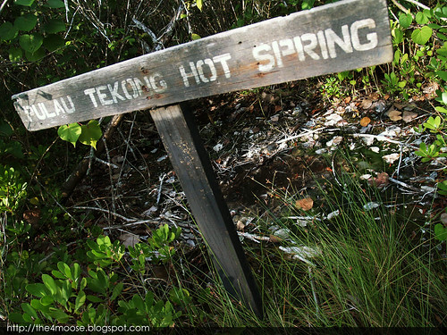
The hot spring has a wooden boardwalk leading to it (a forum post claimed that the Specialists’ Mess actually sponsored the building of it). The hot spring was surrounded by a square shaped boardwalk with a “Pulau Tekong Hot Spring” sign at its entrance. The hot spring can be easily seen using Google Earth as the surrounding vegetation is rather short (According to NUS Mangroves of Singapore, a Lumnitzera racemosa forest surrounds the hot spring.)
From my observation of the hot spring in early 2010:
The water is very calm and reflective. It was warm rather than boiling hot. Streams of bubbles rising from the ground of the hot spring could be observed occasionally. The faint smell of sulphur was apparent and steam was observed near the sign of the hot spring.
The vegetation around the area was quite short like tall lalang and there is a rustling noise throughout the area.
A forum post suggested that the boardwalk was built with funds from the Specialists’ Mess.
As mentioned earlier, Kampong Unum has been a hot spot for tales of the supernatural. There were stories of one smelling the commonly cited fragrance of frangipani before a strange occurrence such as group getting separated yet unable to hear each other even though they were very near to each other and missing cases when carrying out training at Unum were just some of the colourful tales one gets to hear when Unum was mentioned on Pulau Tekong or in the army. Looking at the 1964 map, I would not be surprised by the number of tales surrounding Unum especially the hot spring as it was within the proximity of a former Muslim cemetery.
If you are interested in how the hot spring looked like years ago (it hasn't changed much actually), you might want to check out the photographs of Pulau Tekong Hot Spring can be seen in John Larkin’s Website.
On a side note, John Larkin also has an album of photos of Dempsey Hill before there were Zento, White Rabbit, Les Amis, Muthu Flavours and Hiroki. That's right the Old Dempsey Hill.
Just a few days ago unk Dicko just posted a marvellous post about Tekong. An interesting post about how men called apeks were sent to Tekong to collect fruits for their towkays in Changi Point and a Pulau Tekong master map he did with much effort in the 1980s! One of his landmarks, the abandoned temple can be found in the 1964 Map as well near Sungai Belang.
Unk Dicko also had a post about travelling on an RPL and IE and NIE Training Camps being held in Tekong. Before the Penguin exist, this was the mode of transport military personnel took to travel to the island.
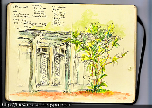
P.S As I read his post, there was a reader who commented about Old Camp 2 along Tekong Highway after Rocky Hill. I don’t know whether the Camp 2 he was in was the same as the one we used as FIBUA training today.
I happened to draw a sketch of it when I was a recruit. We were listening to our entertaining encik but I was more intrigued by the old structure, I wonder how it was like before it turned into a ground for storming, scanning etc. My enciks referred to it as “Old Camp 2”.


as usual, i love the drawings! :D
ReplyDeletehaha thanks! I realized I have very little traditional coloured works nowadays =/
ReplyDeleteCamp 2 , Camp Commandent Office home of all the service men
ReplyDeleteDriver , RP, storeman ,cooks , mechanic , boatman , generatorman ;) history!
1994-1996
to Anonymous: thanks for the info!
ReplyDeletei grown up in sungei belang,No 264-5, when i was in primary school, i followed my father to the pawn pond to catch fishes and prawn, life is interesting, but tough too, farming, rubber tapping... which i still tell my children the tekong stories
ReplyDeleteto Low Xin Min: wow, I wonder how it looked like then. Pity little is left from the past of Tekong, only foundation steps of a temple or those colonial era buildings, nothing left of the kampongs and farms today.
ReplyDeleteHello to Low Xin Min,
ReplyDeleteI am currently collecting pictures and stories regarding Pulau Tekong, probably for a future book or blog.. It's nice to hear from someone living in the remote areas of Tekong, as for now I only manage to get
old pics form Selabin, Pahang and Permatang. I wonder if you have any pictures from Sungei Blang and the other areas. I hope you can contact me
at my email : mdbsms_07@yahoo.com
To XinLi,
I'm not sure if you remembered me, I am still in the process of finding more info rgd old Tekong, definitely a very tough assignment. I will share it to you once I'm satisfied with my findings, I can't wait to do that however it has been tough going..
Hi,
DeleteWe, teachers, used to organize Youth Leadership Training Camps in P Tekong from 1968 to the early 70s.
Former TTC Camp Instructor
Hello ANONYMOUS...do you have any pics from there?
ReplyDeleteI had my posting to CCO Pulau Tekong frm 1993-1996. Very found memories. Being in-charge of the maintainance, I get to travel round the island. I enjoyed and appreciate very much being able to be in the nature and going round the island.
ReplyDeletewow I envy you! =)
DeletePulau Tekong is a very beautiful island, I actually missed the island very much after ORD =/